Blog
"Que sua luz inspire os outros a encontrarem o melhor de si." - Fortunato Guirrugo

ANALYSIS OF LAND USE AND COVER IN CABO DELGADO
July 1, 2024 | Fortunato Guirrugo
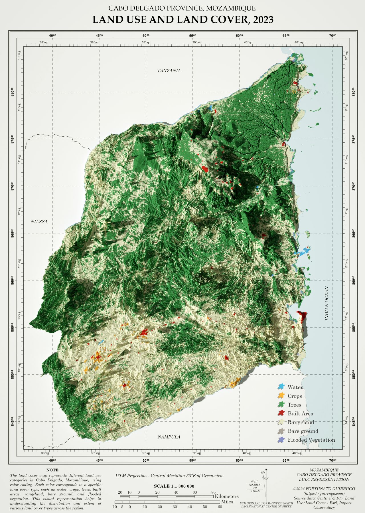
The analysis of land use and land cover in Cabo Delgado highlights seven main categories: bare ground, flooded vegetation, crops, water, built area, rangeland, and trees.
The classes obtained show the following distribution of land use categories:
- Bare Ground: 11 861 hectares
- Flooded Vegetation: 12 636 hectares
- Crops: 30 217 hectares
- Water: 38 000 hectares
- Built Area: 43 812 hectares
- Rangeland: 3 677 045 hectares
- Trees: 3 971 057 hectares
Data analysis reveals that most of the area is occupied by rangeland and trees, indicating a predominance of forestry and agricultural activities. This predominance suggests that Cabo Delgado has vast areas of natural vegetation cover and use for extensive livestock farming, which have significant implications for the conservation of biodiversity and sustainable management practices for natural resources.
Historically, Cabo Delgado has experienced substantial agricultural activity and livestock farming, supported by its vast natural resources. The large areas of rangeland and forested regions play a crucial role in maintaining biodiversity, providing ecosystem services, and supporting the local economy through agriculture and livestock farming. Moreover, the relatively smaller built area indicates a predominantly rural setting with focused urban development.
Check it out on: https://www.linkedin.com/in/guirrugo/
