Blog
"Que sua luz inspire os outros a encontrarem o melhor de si." - Fortunato Guirrugo

ANALYSIS OF LAND USE AND COVER IN MOCUBA
July 1, 2024 | Fortunato Guirrugo
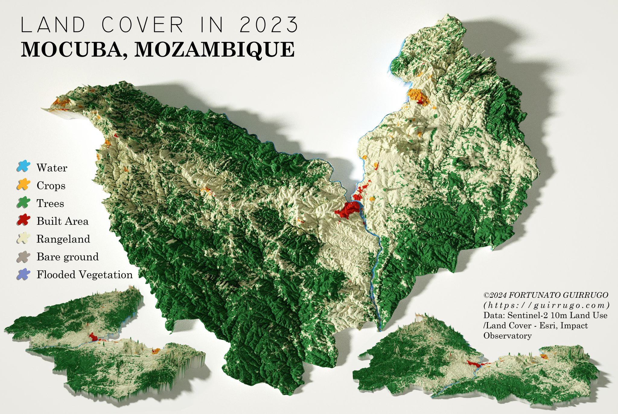
The analysis of land use and Land Cover in the Mocuba district highlighted seven main categories: water, crops, trees, built area, rangeland, bare ground and flooded vegetation.
The classes obtained show the following distribution of land use categories:
- Water: 4 294.46 hectares
- Crops: 5 138.64 hectares
- Trees: 470 978.08 hectares
- Built Area: 4 283.01 hectares
- Rangeland: 392 028.78 hectares
- Bare Ground: 504.59 hectares
- Flooded Vegetation: 483.86 hectares
Data analysis reveals that most of the area is occupied by trees and Rangeland, indicating a predominance of forestry and agricultural activities. This predominance suggests that Mocuba has vast areas of natural vegetation cover and use for extensive livestock farming, which may have significant implications for the conservation of biodiversity and sustainable management practices for natural resources. As observed by Ribeiro et al. (2018), regions with predominant forest cover, such as the Miombo woodlands in southeast Africa, play a crucial role in maintaining biodiversity and providing ecosystem services, reinforcing the importance of sustainable management practices.
Reference:
1. https://opais.co.mz/proteccao-da-floresta-do-miombo-em-debate-em-washington/
2. https://www.researchgate.net/publication/353347716_Crown_morphometry_for_two_valuable_timber_species_from_Miombo_woodland_in_Mozambique
3. Ribeiro, N. S., et al. (2018). "Land Use and Land Cover Change in the Miombo Woodlands of Southeast Africa: Implications for Carbon Storage and Climate Mitigation". Journal of Land Use Science, 13(1-2), 105-121.
Check it out on: https://www.linkedin.com/in/guirrugo/
