Blog
"Que sua luz inspire os outros a encontrarem o melhor de si." - Fortunato Guirrugo

LAND USE AND COVER IN THE SABIE
June 20, 2024 | Fortunato Guirrugo
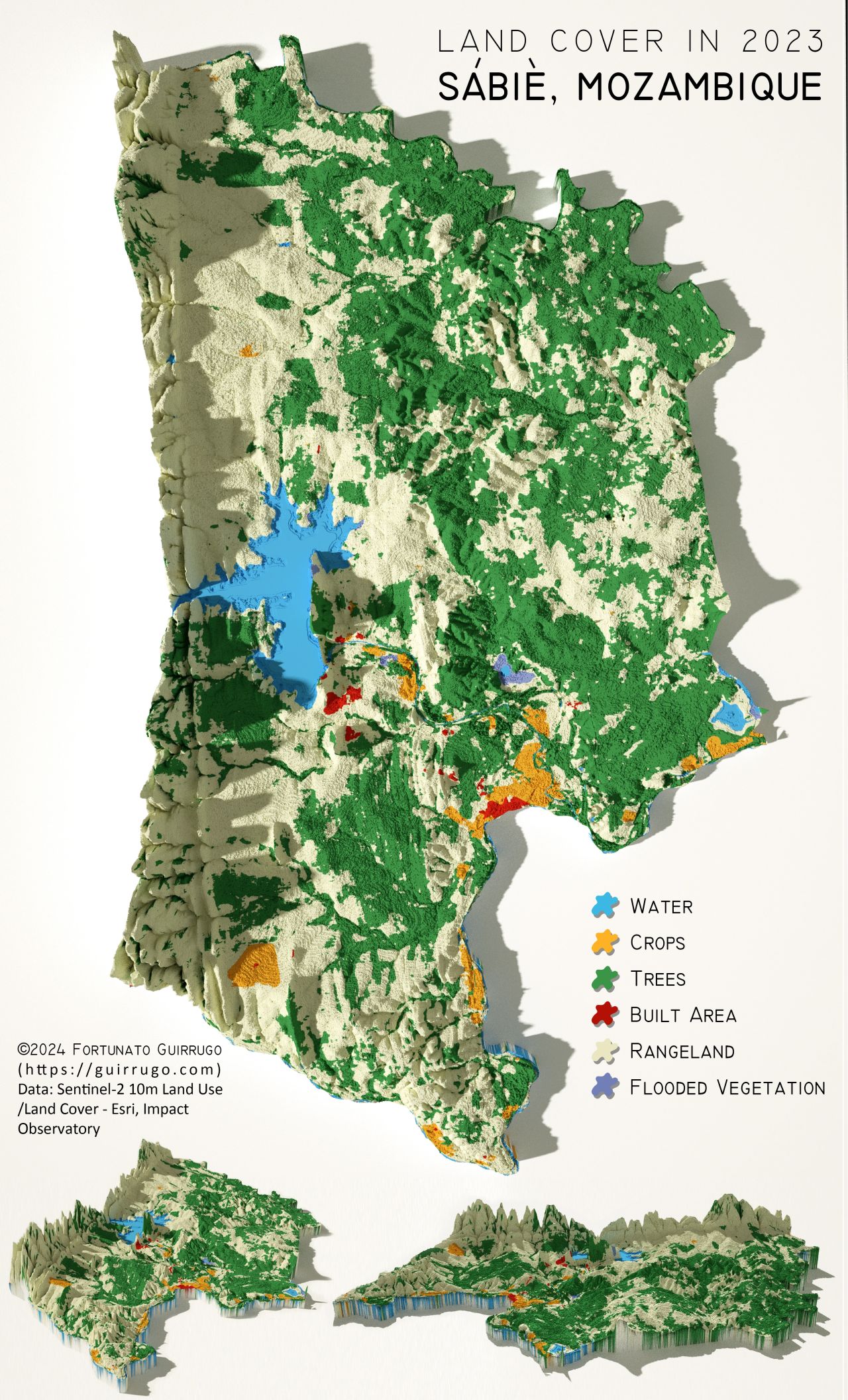
The analysis of land use and cover in the Sábiè highlights six main categories of land use: water, crops, trees, built area, rangeland and flooded vegetation.
The results obtained show the distribution of land use categories in the studied region:
- Water: 2 885.70 hectares
- Crops: 7 364.19 hectares
- Trees: 14 051.75 hectares
- Built Area: 21 814.68 hectares
- Rangeland: 30 126.58 hectares
- Flooded Vegetation: 4 164.03 hectares

Data analysis reveals that most of the area is occupied by Rangeland, followed by built-up areas, indicating a significant presence of urban and rural activities. The areas dedicated to crops and trees are also substantial, reflecting the importance of agriculture and forestry in the region. The presence of areas of water and flooded vegetation highlights the relevance of water resources and associated ecosystems.
See more on: Fortunato Guirrugo | LinkedIn
Credits to Milos Popovic, PhD